Dismal Nitch, Cape Disappointment and Jake the Alligator Man?
In typical Geezer On The Go style, we morphed a 2-day Seattle seminar into an 8-day road trip through Washington State.
Twenty minutes after leaving our Portland home, Conde’ and I, with puppy dog Ari in tow, crossed the Interstate-5 Columbia River bridge. The Oregon / Washington state lines are at river’s center. I find comfort in this equitable division. The Columbia is North America’s 4th largest river and a critical resource for the environmental and economic well-being of all who share her bounties.

We followed the river’s north shore for several hours. It was a cold stormy day with high buffeting winds accompanied by a staccato rap from slanting sheets of rain. Apt weather for a visit to Dismal Nitch.

On June 20, 1803 President Thomas Jefferson instructed Captain Meriwether Lewis to lead a 10-12 man exploration mission of the Missouri river and its “principal streams” to the Pacific ocean. They were to map and take detailed notes during the journey. The goal, to establish the best means for commerce across the great expanse of land, now known as the United States mainland. Lewis recruited Lieutenant William Clark to join the mission. The infamous Lewis and Clark expedition was born.
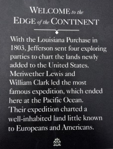
A November 10, 1805 entry from Clark’s journal details a miserable 10-day delay to cross the Columbia and to return to Fort Clatsup (Oregon side). Clark’s precise description of their temporary campsite was “that dismal little nitch.” It is now a picnic area with interpretive signage along Highway 401 across from Astoria Oregon.

I easily imagined the expedition’s angst on our visit. I too saw the rage of the mighty Columbia river roiling with windblown whitecaps. Without a doubt, attempting to cross in a small vessel during such weather would be foolhardy. I wondered what Clark’s journal entry would have read if they had traveled in the middle of August instead? Perhaps a historic picnic area called “Devine Nook” would have resulted.

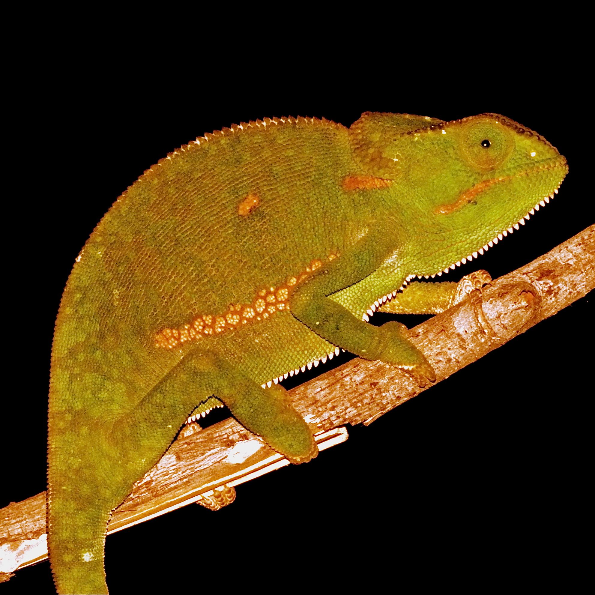
The Long Beach Peninsula claims fame to the longest beach in the US. In the town of Long Beach one can snag a great basket of fish and chips, eat Willapa bay oysters and shop for souvenirs. Long Beach is also home to Marsh’s Free Museum which is a misnomer. Marsh’s is actually a shop crammed with trinkets and curios for sale. Marsh’s main draw is the mummified body of Jake The Alligator Man, an unofficial and hugely embraced mascot of Long Beach. Stories of Jake’s origin’s remain murky. Part of his mystique.

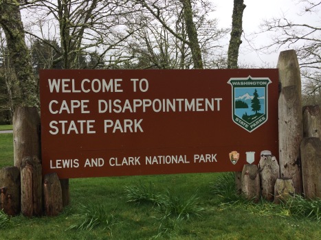
Cape Disappointment State Park comprises 1,882 wooded acres on the peninsula’s far southern tip. You can see the Columbia river and Pacific ocean merge in a majestic confluence. The narrow passage from the ocean into the river used to be very dangerous and often resulted in disaster, including many sinking ships. Thus, the park’s name.


In reality the area is far from disappointing. There is ample camping and lot’s of hiking trails. The Lewis & Clark Interpretive Center is well curated and fronted by the remains of Fort Canby’s two circa 1905 batteries. The historic lighthouses are interesting, offer stellar views of the ocean and are, well, historic.

The Willapa National Wildlife Refuge is divided into three distinct areas. One section is on the north end of the Long Beach peninsula, just past Oysterville and abutting Leadbetter Point State Park. Plenty of bucolic nature filled hiking trails, some with views of Willapa Bay to the east and the Pacific ocean in the west. A delightful way to spend a few hours among nature.

Long Beach to Port Townsend for a Ferry Ride
After 2-days exploring the peninsula, it was time to move on. We got an early start for a 4-hour drive northeast. The goal, a 3:30 pm ferry reservation from Port Townsend to Whidbey Island with extra time for exploring along the way.

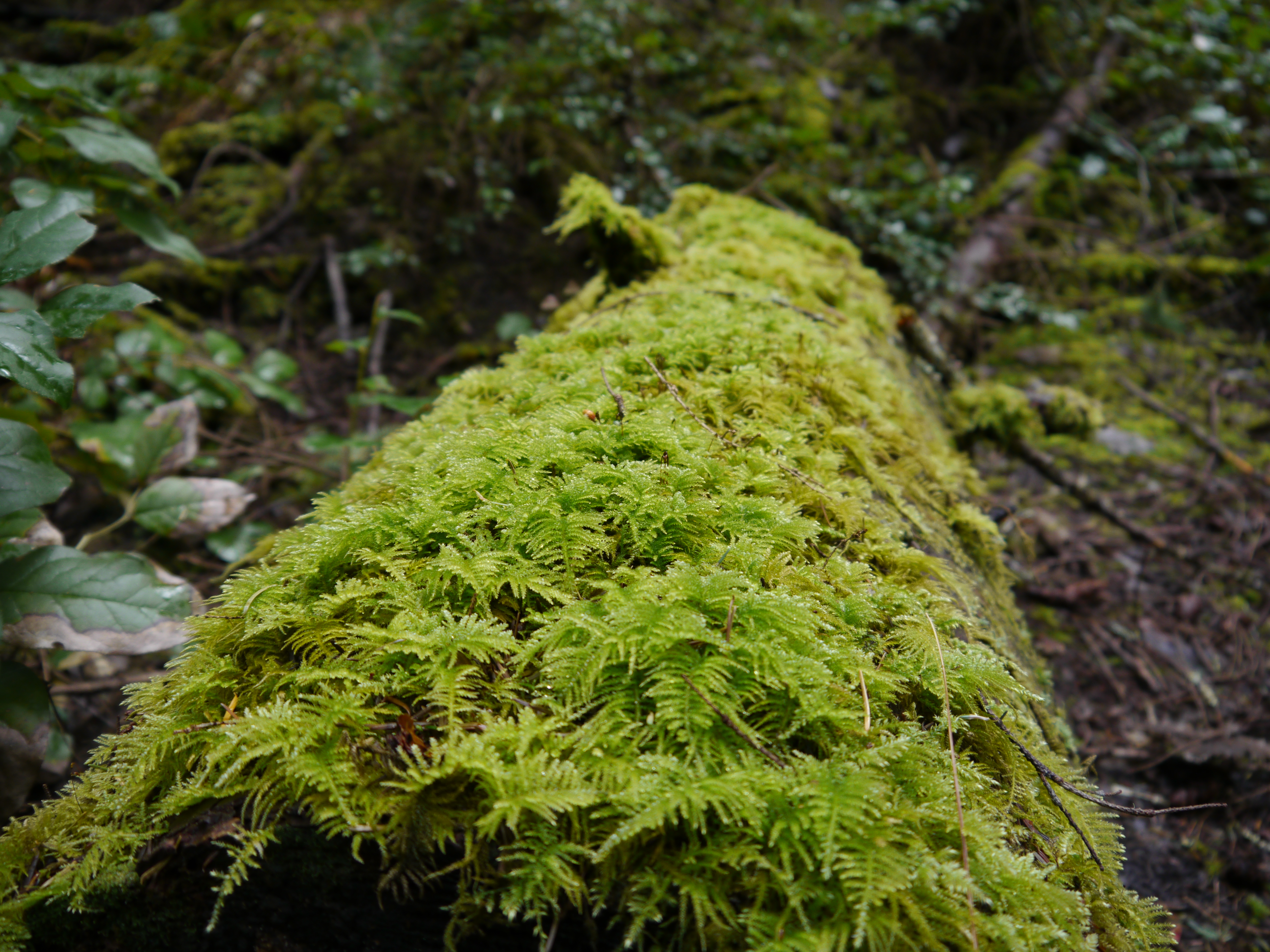
Our first stop was a section of the Willapa Wildlife Refuge along southern Highway 101 just west of the peninsula. A bayside gallery art installation trail meanders in a 1-mile loop peppered with interpretative boxes and wildlife sculptures. The morning was clear and chilly. The air damp and filled with the sweet aroma of fresh evergreens and earthy forest mulch. I relished the head clearing tree bath stroll. An auspicious beginning for a fun-filled sunny day.


Leaving the refuge we traveled northwest, stopping at Alderbrook Resort in Union for lunch. The food was very good and a healthy welcome change from fish and chips. The restaurant overlooks the Hood canal with views of snow-capped mountains. After lunch we continued north along the Hood Canal on a scenic, twisty, two-lane section of Hwy. 101 through the Olympic National Forest. I learned the canal is popular with scuba divers due to its “calm clear waters and giant Pacific octopus.” Didn’t partake in that adventure. Just before the Hamma Hamma river we encountered the Hama Hama Oyster Farm Can’t explain the spelling disparity. Too bad we weren’t hungry!

We arrived in Port Townsend almost an hour before our car ferry reservation. The ride is 45-minutes across Puget Sound to the Coupeville ferry port on Whidbey Island. We took advantage of the extra time to drive through Port Townsend. Beautiful historic Victorian homes spot hillsides overlooking the Sound. A dreamlike setting. Almost made we want to live there … almost… It was a rare sunny day.


The Washington ferry system is incredibly efficient. We disembarked right on schedule, drove to our cabin on a pond in the woods arriving before 5:00 pm. We cooked our dinners in. At night the frogs serenaded with oddly timed symphonic compositions. What a wonderful base for exploring Whidbey Island!

Whidbey Island
Whidbey Island is approximately 50 miles long by 12 miles wide, population 80,000. It is home to a large US Naval Air Station and Field. There are acres of active farmland, old growth forests and plenty of public spaces for hiking, camping and enjoying the spectacular scenery.
On our first day we visited Oak Harbor, the island’s largest city, pop. 22,000. I was really glad we happened upon, and popped into, the Chamber of Commerce Visitor’s Center A delightful young woman imparted ample useful information. I left with an armload of free maps that proved essential for planning daily hikes. And, she threw in a couple of bottles of water, gratis. Made Ari happy.

Washington State Park system requires a paid pass for parking. Called the Discover Pass, you can pay $10 for each single day or $30 unlimited for one-year access. Many parks have kiosks where you can purchase on site. There is a $99 penalty for failure to use a parking pass.

Deception Pass State Park is at the far northern end of Whidbey. The park’s name comes from the area’s proclivity to shifting fogs. There is hiking trails on both sides of Hwy. 20 and across Deception Bridge on Fidalgo Island. (Learned this from a Chamber map). We picked the areas of West Beach by Cranberry Lake and then to North Beach for our hike. It was rainy with welcome sun breaks. Loved every minute of it.


Whidbey Island has a number of cities ranging from “don’t blink” tiny to real cities. Each area has a distinct personality. Some are touristy and others totally local. We ate everything from local Bar-B-Que in Oak Harbor, Jalapeno Cheesburgers in Clinton to duck confit in Langley.
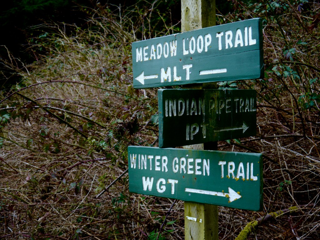
Just north of Langley are lush hiking and horse back riding trails, created, preserved and maintained by the non-profit Washington Trail Association. The Putney Woods, Saratoga Woods, & Metcalf Trust Trail System provided a quiet clean air escape from the world on well marked and maintained trails. We did not see another sole the day we visited.


We spent a couple of hours in the delightful tourist town of Langley before catching the Clinton ferry for a 20 minute ride back to the mainland north of Seattle. Lot’s of good shopping, book stores and cafes. Whales frequently pass through the Sound along Langley and can been seen from the beach or boardwalk.


I’m ending the story of our Washington road trip on Whidbey Island. Seattle is a story in and of itself. Thanks for joining me on my adventures! See you next month in St. Augustine Florida.

Leave a comment